Friday, September 26, 2014

St. Mary's Day Trip

     As our time at St. Simons approaches its end, I have several places I want to visit before leaving; one of which is the small town of St. Mary's.  We were pleasantly surprised by this tiny pin point of a town.  
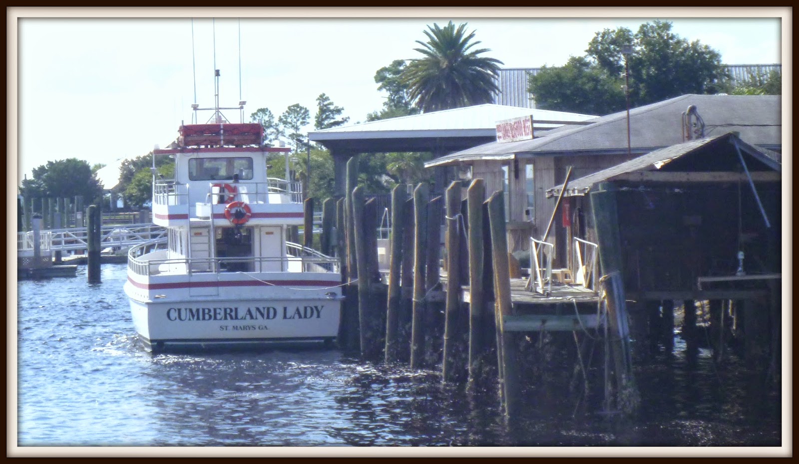
     The city which is the gateway to the Cumberland Island National Seashore and provides both a visitor center and boat access to Cumberland Island.  The town was established in 1787 and was made an U.S. Port of Entry in 1799.  The waterfront park is a terrific place to watch the shrimp boats come in with their catch or just sit in one of the swings and chat with friends. 
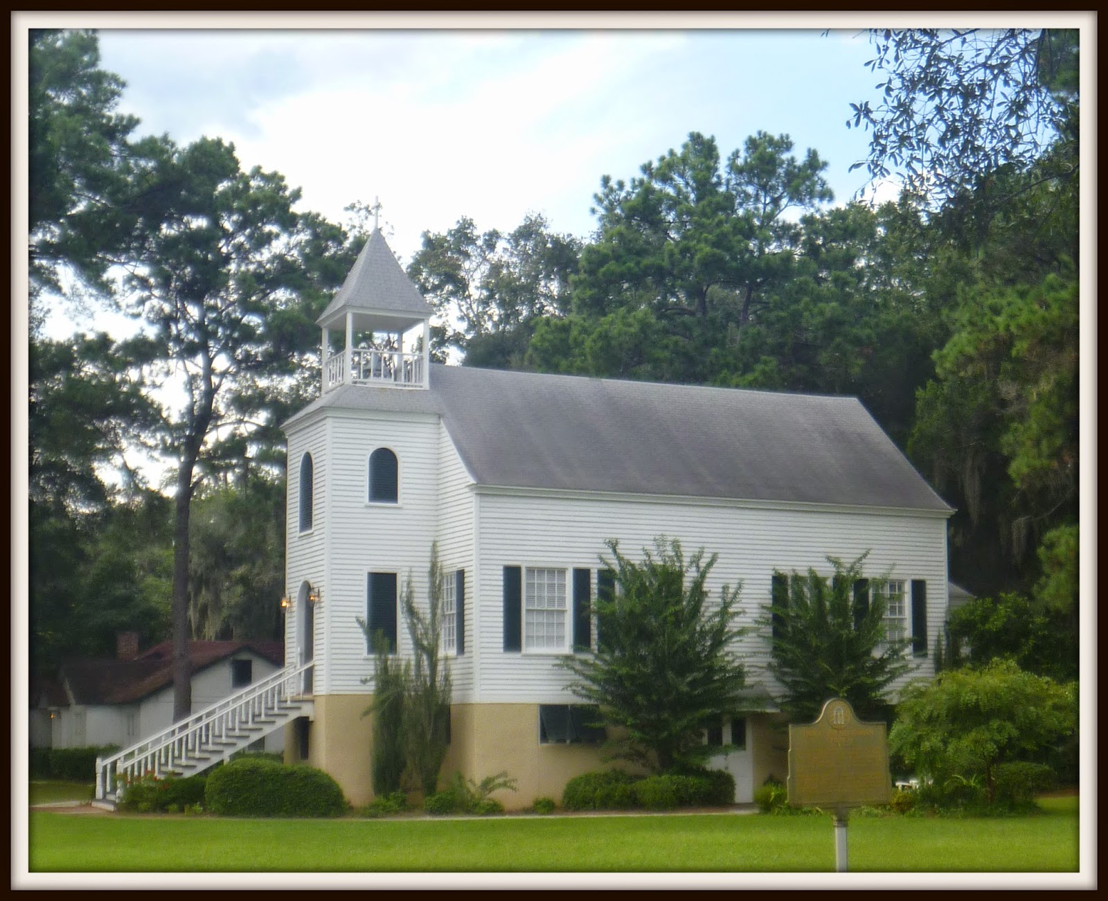
      The First Presbyterian Church of St. Mary's, built in 1808 is the oldest Presbyterian Church building in Georgia. 


Of course, no trip to a coastal town would be complete until we visit the local marina.  Lang's Marina has two sets of docks which is not unusual.  What is unusual is that they are separated by about a 2 block walk.  The East Dock is mainly used by commercial fishing boats and the ferry.  The West dock is on the other side of the waterfront park which is a great place to walk the dogs after a long day on the water.  The St. Mary's river has plenty of depth with 12 feet of water a mean low tide.


Joy


Thursday, September 25, 2014

Zig Zagging Through the Marshes

Jekyll Island has almost 20 miles of bike trails zigzagging along the beach, through the historic district, alongside the golf courses and through the forestWe rode almost all twenty of these miles--in one day.  We were in awe of the beautiful marshes.

Look closely to see the bridge to St. Simons


The Georgia coast is the most western coast on the Atlantic seaboard. It is at the center of the Georgia Bight a funnel shape coastline extending from North Carolina to Florida. At high tide water from Florida to North Carolina pushes up on itself creating 6 to 8 foot tidal changes along the Georgia coast compared to 3 foot tidal changes at the northern and southern tips of the bight.  These tides allow the development of marshes.  It is estimated that Georgia has 378,000 acres of salt marshes.  These marshes help foster the growth of economically important fish and shellfish by providing shelter for young crabs, shrimp and oysters.  The marshes also filter pollutants and serve as a buffer from storms offshore.


There is significant construction happening around the island.  The grocery store above in the modular building is planning to move into its new location in January.  Some of the older hotels are undergoing massive renovations.  


Joy 


Wednesday, September 24, 2014

Early morning at Golden Isles

Most mornings I like to watch the sun come up over the marina with a cup of coffee.  The pilot boats come in early for fuel before heading out to help the container ships into the Port of Brunswick and fishing boats head out early with an eager often yawning crew. Today, in the cool morning breeze, I stepped out with the camera.  


Friday, September 19, 2014

Of frogs & fairies

We have been at home in Bold Springs for several days taking care of business, playing tennis, playing some more tennis and taking care of more business.  I came across something Caroline wrote a few years ago and decided to post this today.  I hope you enjoy it as much as I do.


Bold Springs, Georgia.  Contrary to what the name suggests, this is a microscopic town about thirty minutes from nowhere.  The community is so petite that it does not even have a post office. While most people may overlook this insignificant blip on a map, to me, it is home.  Home is a place where fairies lived under mushrooms, frogs were cleverly named Ribbet and butterflies gave you kisses on your cheek.  It was magical. 

My father moved us to Bold Springs when I was two, my older sister was six, and my mother was nine months pregnant with my baby sister.  We were almost an hour away from the closest family member and half an hour from school and the nearest grocery store. The television received two channels, the plumbing leaked and the basement was not finished.  Looking back now, it is a miracle that my mother managed to survive raising three girls with a husband who worked sixty hours a week.  Because there was practically not television, we played outside. We created our own games and our adventures amongst our 60 acres of woods and fields. We jumped on the trampoline and staged wars, using the wild persimmons that fell from the trees as "ammo".  In the summer, we lived outside. The hot months were perfect for picking blackberries and exploring.  My parents called me Ellie May because I managed to catch every animal from tadpoles to rabbits. My father taught us all about nature; how to tell when a rainstorm was coming merely by tasting the air, how to identify any tree native to Georgia, how to fish. On some nights he would wake us up at four in the morning to watch meteor showers or lunar eclipses. On rainy days, my mother would tell us stories about the good fairies that lived in the pretty orange, white or pink mushrooms and the evil fairies that lived in the black ones. 

We never stayed bored for long.  One year we transformed the old barn on our property into a school house where my older sister would teach us about mathematics and parts of the human heart. We always had dogs and cats roaming around as pets and we even started breeding peacocks.  In the winter when we were pent up in the house, I started reading and I never stopped. From a young age I read everything I could gets my hands on. When I rean out of books, I made up stories about princess warriors or astronauts. I was always a curious child. I studied every bug I came across.  While I am no longer an amateur entomologist, I am still just as curious. I often bother teachers asking things like, "Why did Jefferson have slaves if he thougth it was morally wrong?" My home was not perfect, but the things it lacked helped me grow into a more imaginative person. Though I am ready to move on from the place I've called home, I know part of me will always be in Bold Springs, Georgia, the elfin community of frogs and fairies, an half hour away from the nearest grocery store. 

Thanks to Caroline for writing this sweet essay about growing up!

Joy


Monday, September 15, 2014

Channel Markers Gone Awry

We depend on channel markers whenever we move the boat.  The markers aid boaters in navigation in the same way as highway signs aid drivers.  One of the most important purposes of marine aids is to keep vessels with a deep draft (how far the boat goes under the surface of the water) from running aground and becoming stranded.  Meandering Joy has a draft of 5 feet. Markers and buoys do not have words printed on them but are identifiable by shape and color.  Color and shape are more visible in bad conditions like fog or rain and printed words.  Markers which are Triangles are Red and Square Markers are Green.

We are always careful when coming by Jekyll Island on the Jekyll River which is notoriously shallow at low tide.  Steve takes great care in planning the timing of our trips so that we don't risk running aground and being stranded until the tide rises.  We had the additional problem of missing channel markers when we came through most recently.

Marker found floating down the river was attached to Red 20


Another Red Marker pushed over so far that it was almost impossible to see
We are thankful for paper charts, and two different electronic charts that aid in our navigation when the actual markers are not where they should be located.

Joy

Saturday, September 13, 2014

Good Morning Cumberland

I can't believe I am going to say this but here it is--Steve won't believe it--I love the mornings when we are at anchor.  I like the security and creature comforts of docking at a marina, but oh my, the serenity of the mornings at anchor is something quite beautiful.  

Watching and listening to the creatures who live outside wake up and get moving is enchanting.  The birds are talking to one another and all the animals are looking for some breakfast.  


Joy

Friday, September 12, 2014

Live Oaks

Live Oaks flourish on Cumberland Island.  Those oaks near the middle of the island are draped in moss keeping the area beneath shady.  The oaks closer to the ocean and beach have less moss but the limbs which grow more horizontally than vertically.  These limbs form a canopy of sorts over the boardwalk from the beach to the camp.  Live Oaks are so dominant on the island because they are able to withstand the wind and salt spray than many other trees.  The live oak is considered an evergreen because it does not lose its leaves in the fall, but rather loses it leaves in the spring when  new leaves are starting to form. The trees have a shallow root system which spreads out the same distance as the limbs overhead.  The formation of the roots and limbs stabilizes the tree against the harsh winds that can come through barrier islands. Live oaks can live for  300 years--there is one tree on Cumberland at the Greyfield Inn which is thought to be 350 years old. 


After walking around the island for about 4 hours we found our way back to the dinghy dock--


Joy

Thursday, September 11, 2014

The Horses of Cumberland

It is thought that the band of feral horses residing on Cumberland Island were brought over by English settlers in the 18th century.  There are an estimated 150  horses which are similar to horses which reside on Assateaque Island, the subject by the children's book Misty of Chincoteaque by Marguerite Henry. 


Wednesday, September 10, 2014

The Beach on Cumberland

The beach of Georgia's largest and most southern barrier island is not littered with high rise condominiums or homes.  There is nothing to see but nature while walking along the beautiful white sands. 


Joy

Tuesday, September 9, 2014

Dungeness

As we headed north  on the Cumberland River we found an anchorage near the Greyfield private dock.  We passed both the Sea Camp and the Dungeness docks.  There were other boats anchored near these docks, so we went further north to avoid them.  Steve took Piper and Jack for a quick stroll and then returned for me in the dinghy.  It was much too hot for the dogs to traipse around the island with us on this day.  

We tied up the dingy at the Dungeness dock.  The Ferry was waiting for its passengers to board for the return trip to St. Mary's.  The National Park Service runs Cumberland Island and maintains honor system deposit boxes for the $4.00 per person fee which is good for 7 days. I found the fee envelopes--deposited my $10 because I didn't have any dollar bills.  I filled out the form which wanted my mailing address--I am sure that is so they can return the $2 I overpaid.  We did not see any park personnel other than maintenance crews. 

I thought I was going to have to search for the wild horses that roam the island.  I didn't have to search at all--they were leisurely enjoying themselves all around us. 


Steve and I were both eager to see the ruins of the estate and the beach.  We enjoyed our walk under the canopy of trees and moss along the unpaved trail. 


James Oglethorpe had Fort Andrew built on the northern end of the island which was then known as Missoe in expectation of a Spanish attack.  A village for soldiers and their families called Barriemackie grew around the fort.  The fort and the village were later abandoned when the threat from the Spanish disappeared. Oglethorpe had a friendly  relationship Chief Tomochichi who offered much assistance to Oglethorpe when he established the first colony in Georgia.  Tomochichi's nephew had visited England and was enchanted with the kind treatment he received by the British Royalty.  He wanted the name changed from Missoe (which means Sassafrass) to Cumberland after the Duke of Cumberland, so Oglethorpe renamed the island as a favor to Chief Tomochichi. 

While on newly named Cumberland Island,  Oglethorpe built a hunting lodge he named Dungeness.  The name Dungeness can also be traced back to England. The Dungeness headland is on the coast of Kent, England.  After the American Revolution, Much of Cumberland Island was aquired by Nathanial Greene.  After his death in 1786, his wife Catherine and her new husband built mansion on the island.  She named this four story tabby mansion after Oglethorpe's hunting lodge, Dungeness


Dungeness Ruins


Guest House Ruins
Joy

Monday, September 8, 2014

Heading to Cumberland Island

Cumberland Island is about 17. 5 miles long and is considered the most western point of shoreline on the Atlantic Ocean in the US.   It's 36,000 plus acres consist of marsh, mudflats, tidal creeks and beautiful untouched beaches.  The only access to the island is by boat.  The Cumberland Island Ferry in St. Mary's offers a 45 minute ride to Cumberland Island.

Cumberland Island is a part of the national seashore as a result of a bill  signed by Richard Nixon in 1972.  Much of the island was sold to the federal government by the Carnegie family.  The Mellon Foundation made donations which aided in Cumberland Island becoming a National Park 

The history of the island is very interesting and can be read in great detail here at the Cumberland Island Conservancy website. 

As we approached Cumberland Island, the light house on the northern end of Little Cumberland Island came into view.  It marks the entrance to the St. Andrew Sound and the Satilla River.  Prior to the Civil War the light house was called the St. Andrew Lighthouse.  It was deactivated in 1915.  


We meandered around to the southern end of Cumberland and came by King's Bay Naval Station passing the western side and Drum Point Island and then headed back north on the Eastern side of Drum Point Island to find an anchorage. 

This boat watches all boats very carefully. 


 It is a little unnerving to think there may be submarines below us in King's Bay.

Cumberland Map
We anchored just above the Sea Camp Ranger Station Dock, and took the dinghy to the dock just below the Ice House Museum.  

Joy