
Cumberland Island is a part of the national seashore as a result of a bill signed by Richard Nixon in 1972. Much of the island was sold to the federal government by the Carnegie family. The Mellon Foundation made donations which aided in Cumberland Island becoming a National Park
The history of the island is very interesting and can be read in great detail here at the Cumberland Island Conservancy website.
As we approached Cumberland Island, the light house on the northern end of Little Cumberland Island came into view. It marks the entrance to the St. Andrew Sound and the Satilla River. Prior to the Civil War the light house was called the St. Andrew Lighthouse. It was deactivated in 1915.


 |
| This boat watches all boats very carefully. |


It is a little unnerving to think there may be submarines below us in King's Bay.
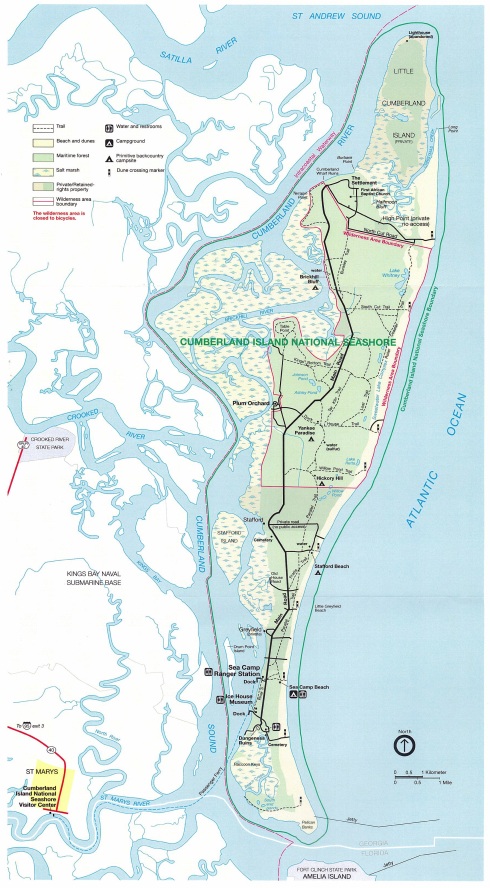
We anchored just above the Sea Camp Ranger Station Dock, and took the dinghy to the dock just below the Ice House Museum. Joy
No comments:
Post a Comment